
Nogal Peak: The Destination
3:39 PM
Note: If you did not read our last blog post, I suggest starting with that here.


 |
| The road which we drove in on. |
 |
| These mountains were absolutely breathtaking. We felt on top of the world. |


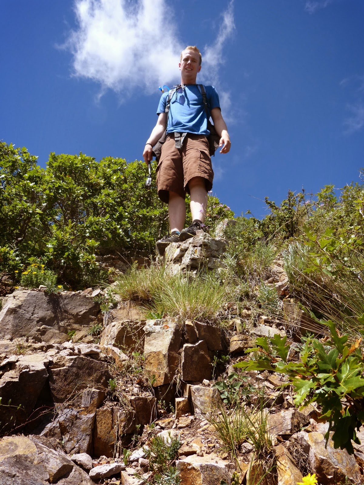
 This past Saturday, we decided to take another shot at conquering Nogal Peak. We ate whole-wheat waffles for breakfast and packed up our camel-back, leaving to make the 2-hour drive around 8:30. As we neared our destination, we began to worry that the low clouds might impede yet another trip. Luckily, that ended up not being the case.
 It was bright and beautiful upon our arrival, and we made a point to shield our exposed skin with SPF 30. Being as ours was the only vehicle in sight, we figured the mountain was ours for the day. Nogal Peak seems to be a hidden gem.
We stuffed my water-proof vest into our backpack and tied Spencer's rain jacket around the outside. We came prepared; and similar to how you don't end up needing a book when you bring it to the doctor's office, we didn't need the rain gear. If we had not brought it, however, it most assuredly would have down poured.
 The ascension has less photographic history than the previous hikes, but because of this, we made much better time. I do not think it took us more than an hour to reach the top, even with multiple stops to catch our breaths and soak in the view.
 |
| Someone is tired. |
 Upon coming to the ledge where we had stopped the previous time, we continued on what seemed the obvious trail. Not long after, we came to the conclusion that Nogal Peak must hardly ever be trekked, as it was overgrown and difficult to meander.
When we had come out the other side of the thicket, we were faced with a near straight-up side of the mountain. Not to be deterred, we used all four limbs to climb to a flatter area, trying our best to follow the over-grown trail. The flatter area revealed some secrets. Secrets which would help any hikers set out to conquer the mountain. It was the wrong trail. What was the seemingly obvious trail, we believe, was where many hikers new to the mountain, go astray. The easier, less-overgrown trail, is easy to pass and not even see, as you are tired and have your eyes on the clear trail in front of you. In fact, even if you had seen the option of another trail, you most likely would think that the incorrect trail is the trail to take, as it is more clear (at first) of shrubs. Here is your warning. Take the other trail. I am attaching pictures of what each looks like in hopes that any future trekkers be advised of the correct trail. Albeit, either path will get you there. The correct trail is marked with a cairn.

 Climbing on all fours, in any case, becomes necessary. The last fragment of the hike is the most vertical. The ground beneath your feet varies from slate and rock, to loose, yielding dirt. We were both slipping and sliding as we made our way up; trying not to slip back and stumble the other. It was intimidating to come to, but not so bad once you were making your way up.
Seeing the peak above us was all it took to feel adrenaline rushing through our bodies and sprint to the top. My throat hurt from whooping.
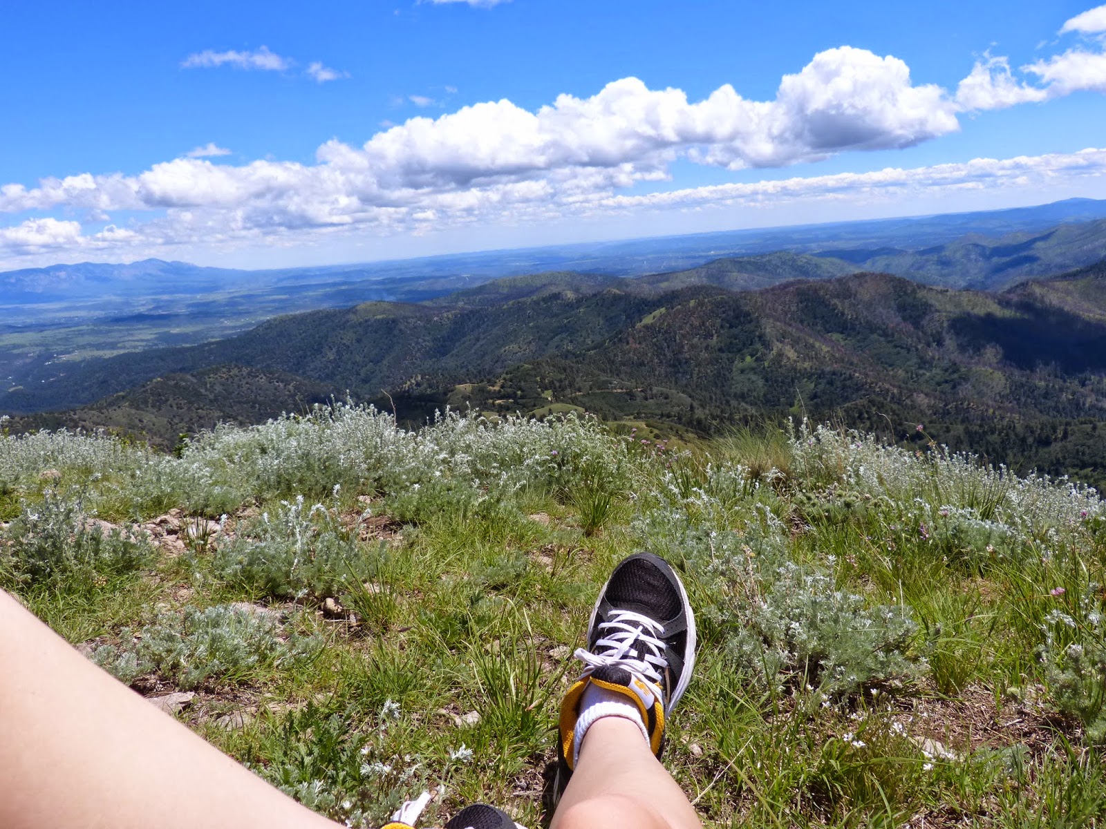
 It was breathtaking. 360 degree view. A cairn fashioned from rocks and a branch. Two geodetic survery markers. It was the ideal spot to consume Saturday's lunch. The view was marvelous, and these pictures can not do it justice.
 We even found a geocache (a hidden treasure) using our Garmin GPS. We signed and dated the logbook and took from the cache a "travel bug" (an item which travels the globe and has a log online where you can view all the places it has been) who has the goal of traveling west before returning to Kentucky. We will be bringing it to California with us this week to place in a cache closer to it's destination.
Laying on the mountain, we soaked in the views and took plenty of pictures. Neither of us wanted to leave. Because we finally made it to the top, I realized we would not have that excuse to come back in another couple weeks. Although we both want to, we want to explore other trails for a while, seeing if we can not find other hidden gems.
Nogal Peak, thus far, has been our favorite hike. Definitely a must see.


 |
| Finding a geocache |


 |
| Stinging nettle got me. This is at the top, when it's been faded, but you can still kind of see it. |


 |
| While eating lunch, we saw these people making their way. Unfortunately, they didn't make it to the top. We had the peak to ourselves the whole time. |


 |
| Me doing The Lion King pose |


 |
| Just a wee bit overgrown |
 |
| Stinging nettle. A hiker's nemesis. |

 |
| Left: the trail we should have taken, but didn't see. Right: The trail we came from. |
 |
| Left: The (wrong) trail we took. Right: The right trail. |


 |
| Although we lathered ourselves in sunscreen, we got BURNT! |
Some other random pictures:
 |
| This was taken about a mile from our house. Beautiful sunsets. |
 |
| Spencer had to rub it in... The gas went under $3! |
 |
| We got a Ninja blender! Ours was dying. We have been using it to make healthy chocolate banana fudge-sicles. |


Yes...we get tarantulas. This was from our run the other day.


 |
| The chocolate fudge-sicles I was refering to. |
 |
| Dead vinegaroon outside our apartment |
Also...we are SO EXCITED to see our family this week and go camping!


.jpg)

1 comments
Love the pictures. Can't wait to see you. Grandma
ReplyDelete